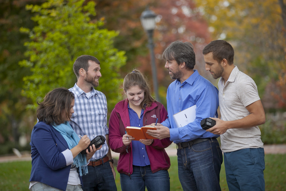
Sami Meyerson ’16 (L-R), Andrew Genco ’06, Amanda Leaman ’15, John Wilson, and Sean Murphy ’11 gather data using Thales GPS devices.
Imagine groundwater seeping through rocks beneath the earth’s surface and large saturated reservoirs where it is held. Known as aquifers, they can be as shallow as 200 feet down or as deep as 2,000. Wells drilled into them provide water for drinking, irrigation, and industrial uses. A precious and vulnerable resource, they are easily contaminated.
Take the Hanford Department of Energy site in the tri-cities area of southeastern Washington for example where aquifers are threatened by leaks from drums of radioactive waste buried in 1942. Andrew Genco ’06 was on the scene. The company he worked for at the time developed a system to monitor the tanks based on a resistivity survey.
Finding, describing, and analyzing water resources is all in a day’s work for Genco, a geophysicist for XRI Geophysics, of Golden, Colo.
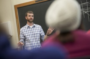
Andrew Genco ’06 provides guidance about using GIS to create maps for particular projects and clients.
“We use electromagnetic pulses to gather data,” says Genco, a geology graduate who returned to campus recently to talk with students about his experience in geophysics and geographic information systems (GIS). He explains that a large hexagonal frame, holding a bundle of copper wires, uses a transmitter to send pulses down into the earth that bounce back and are picked up by a receiver. The data is interpreted to determine whether the pulse went in to clay, gravel, sand, or other material.
The frame is attached beneath a helicopter, which flies in a previously determined grid of lines spaced about 8 to 16 miles apart with the frame about 100 feet above the ground. Measurements can be made in the top 300 feet or as deep as 1,600 feet.
Data is collected in computers on board the helicopter, then converted to a 3D representation of the geology.
Genco has completed projects in Nebraska and Montana and is currently working in Texas to identify the characteristics of aquifers at a site where water resources are limited and detailed information is needed in order to provide better management.
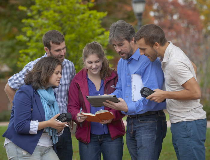
Sami Meyerson ’16 (L-R), Andrew Genco ’06, Amanda Leaman ’15, John Wilson, and Sean Murphy ’11 explore the geology app created by computer science and engineering students guided by Chun Wai Liew, associate professor of computer science, and Larry Malinconico, associate professor of geology.
Genco spoke with students in GIS, a course taught by John Wilson, geology lab coordinator, for 13 years. Emphasizing the importance of the course, Genco notes that he was hired for one of his first GIS jobs on the basis of work he had done in Wilson’s class. “John still had the digital files so I showed them to the employer, and I got the job.” He worked a year as geospatial technician for GCS Research in Missoula, Montana, which helped him realize that he wanted to do more than a career in GIS. He earned an M.S. in geophysics from Colorado State University so that he could focus on geophysical investigations at various field sites.
“I enjoy talking with alumni who come back to campus,” says Sami Meyerson ’16 (Easton, Pa.), a theater major who is taking the GIS course. “It is valuable to hear how they applied their majors. I especially liked Andrew’s story about getting one of his first jobs on the basis of his work in GIS. It made me realize that if I am an unemployed actor, I could use my GIS skills to get a job.”
Fellow geology graduate Sean Murphy ’11, who also met with students, is a geologist for Southwestern Energy of Houston, Texas. He is on call for two horizontal drilling rigs based in the Fayetteville Shale area of northern Arkansas that involve hydraulic fracturing for natural gas. “I predict the depths of different rock layers and then deal with any unexpected issues that arise,” says Murphy, who holds a professional M.S. in subsurface geoscience from Rice University.
He also plans where new wells will be drilled. “I present about five to ten new well sites every two weeks.” The company holds leases in the more than 900,000-acre area.